Enclosed land in France
09.05.2017, by Bénédicte Gaillard
Research: Alexandra Kruse & Bénédicte Gaillard; upload: Bénédicte Gaillard. The entries are still in progress.
The earliest known date of enclosed fields in France is 1229 where the word “méjou” (used to designate the isles of openfield inserted in the isolated enclosed fields) appears in the Charte de Notre-Dame de Beauport.
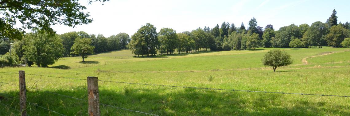
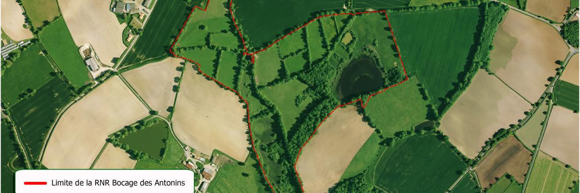
We can observe different types of enclosed fields: barbed wire fence, dam, earthen wall, various vegetations, bocage, forests, stone walls, river, pathways, embankment, hedge.
These different types of enclosed fields can be categorised according to various criteria: types of fences, form of the parcels, orientation of the parcels, use of the parcels.
From the 16th to the 19th Century openfields diminished and gave place to enclosed fields.
However from the second half of the 20th Century many enclosed fields were destroyed to leave way to bigger parcels and to facilitate the mechanisation.
- Gérard Chouquer, « Annie Antoine, Le paysage de l’historien. Archéologie des bocages de l’ouest de la France à l’époque moderne », Études rurales [En ligne], 167-168 | 2003, mis en ligne le 17 décembre 2004, consulté le 29 mars 2017. URL : http://etudesrurales.revues.org/2964
- Flatrès Pierre. La Géographie agraire en France depuis vingt ans, d'après E. Juillard et A. Meynier. In: Norois, n°10, Avril-Juin
- 1956. pp. 228-232;
- http://www.persee.fr/doc/noroi_0029-182x_1956_num_10_1_1129_t1_0228_0000_2
- http://www.ecosociosystemes.fr/monoculture.html
- http://www.persee.fr/issue/geo_0003-4010_1971_num_80_438?sectionId=geo_0003-4010_1971_num_80_438_15295
- Typologie des systèmes d'exploitation agricole utilisés en France [Essai méthodologique]
- [article]
- Essai méthodologique, Jacqueline Bonnamour, Yves Guermond, Chantal Gillette
- Annales de Géographie Année 1971 Volume 80 Numéro 438 pp. 144-166
- http://www.normandie.developpement-durable.gouv.fr/4-paysages-bocagers-a958.html
- https://www.notre-planete.info/actualites/4168-evolution-bocage-benefices-paysage
- http://www.futura-sciences.com/planete/definitions/botanique-bocage-2208/
- http://www.cnrtl.fr/definition/bocage
- http://www.syndicat-bassin-elorn.fr/IMG/pdf/Fiche_action_Prise_en_
- compte_du_bocage_dans_les_docs_d-urba_-_revu_CA_cle8515c6.pdf
- https://www.senat.fr/questions/base/2011/qSEQ110518603.html
- https://inpn.mnhn.fr/habitat/cd_hab/1339
- http://www.polebocage.fr/-Les-bocages-et-les-haies-en-France-.html
It appeared during the 18th Century but the hedges constituting the enclosed fields were destroyed after WWII in order to facilitate the mechanization of the agricultural parcels. But nowadays they tend to appear again.
While the Western agricultural regions in France were mostly closed, the Eastern agricultural regions were mostly open. But this tendency changed when most enclosed fields disappeared, leaving space for openfields. While extensive agriculture used to predominate, the situation changed dramatically from the second half of the 20th Century towards an intensive agriculture.
Mono-culture has been found for a long time in plains where cereals were cultivated (Beauce, Brie, Champagne, Picardie, Poitou) while enclosed fields were not concerned. But around the 1960’s monoculture appeared in enclosed fields too.
It is connected to all these criteria and consequently differs considerably from a region to the other:
Example only in Normandie:
The Bessin: high hedges and big checkerboards
The Plain: lower hedges and big checkerboard
The fattening bocages with irregular forms parcels
La Manche centrale: high hedges on embankments
La Hague bocagère: thick hedges with trees
Le Cotentin: hills, thick hedges
Le Pays d’Auge: hills, rather big and irregular parcels
Le bocage en tableaux (centre of the Basse-Normandie): parallel valleys with regular parcels
Le Pays d’Auge septentrional: mix of valleys and plateaus
Le Pays du Désert: full of groves
Les tableaux bocagers de Cerisy-la-Salle: hedges
Le Bassin de Vire: embankments
Le Houlme occidental: mix of bocages and openfields
L’Avranchin oriental: diminishing bocages
Le Haut Bocage: trees, hedges, embankments
La Hague des grands horizons: embankments
It is still in use today, after a long period of disappearance between the 1960’s and 1990’s, it started be rediscovered and the European Landscape Convention signed in 2000, which entered into force in 2006 in France, contributed to the give back its importance to enclosed fields in France.
It used to be threatened because of intensive agriculture and mechanisation of agriculture, but it is now rediscovered and various actors such as local population, politicians, associations, artists, writers, musicians, video makers work together for the rediscovery of this type of landscape.
It is connected with traditional farms, hamlets, trenches, grasslands, ponds, pools, paths, stone walls. And in terms of production it is connected with forage production and breeding in pastures.
It is connected with specific structures as described in the combination with something typical (above).
In terms of functions it is connected to the size of the fields that limit the possibilities.
During the 19th Century a movement supported the recognition of locality including landscapes, practices, and local traditions. This type of landscape started to be appreciated since the 1960’s-1970’s and has thereby a heritage significance.
It is rather poorly known to the public but this is changing now with the numerous initiatives to contribute to rediscover enclosed fields. The situation is different according to the regions. For example, people are more aware of enclosed fields in the Western parts of France where enclosed fields can mainly be found, than in Eastern regions where enclosed fields are rare.
There is a definition elaborated by the Centre National de Ressources Textuelles et Lexicales. A reference is made in the Code de l’Urbanisme. A classification of the bocages can be found on the website of the Inventaire National du Patrimoine Naturel.


