Enclosed land in Slovakia
27.09.2017, by Bénédicte Gaillard
Research: Martina Slámová, Jana Špulerová, Marta Dobrovodská, Dagmar Štefunková; upload: Bénédicte Gaillard. The entries are still in process.
Enclosed fields have no special national neither regional name. The name of each field was given usually according to land owners (surname) or according to natural specifics of fields. Fields are surrounded by woody plants or by stone walls. Locals use to call them (in the central Slovakia, name depends on region) “medza” (singular form) or in case it was a heap from stones it is called “hrobľa”.
It varies in regions. Assumed origin of this structure is 14th century (Wallachian Colonization) in submountain agricultural regions where these structures have persisted till today. Maybe existed older forms in lowlands and Carpathian basins but they are not present today in intensively used agricultural landscape.
JANČURA, P., BOHÁLOVÁ, I., SLÁMOVÁ, M., MIŠÍKOVÁ P. 2010. Method of identification and assessment of characteristic landscape appearance. In Bulletin of the Ministry of Environment of Slovak Republic. Bratislava: MŽP SR, Vol. 18, Part 1b, 2-51. ISSN 1335-1576.
MIKLÓS, L., HRNČIAROVÁ, T. [eds.] 2002. Landscape Atlas of the Slovak Republic. Bratislava, MŽP SR and Banská Bystrica, SAŽP, 344 pp.
SLÁMOVÁ, M., BELÁČEK, B. 2004. Typology of Relief Shapes of the Historical Landscape Structures. In Jančura, P. eds. Historické krajinné štruktúry. Banská Štiavnica : Partner, 2004, p. 25-31. ISBN 80-89183-09-03.
SLÁMOVÁ, M., JANČURA, P., DANIŠ, D. 2013. Methods of Historical Landscape Structures Identification and Implementation into Landscape Studies. In Ekológia (Bratislava). ISSN 1335-342X. 2013, Vol. 32, No. 3, p. 267-276. doi:10.2478/eko-2013-0023.
ŠPULEROVÁ J., DOBROVODSKÁ M., LIESKOVSKÝ J., BAČA A., HALABUK A., KOHÚT F., MOJSES M., KENDERESSY P., PISCOVÁ V., BARANČOK P., GERHÁTOVÁ K., KRAJČÍ J.,
BOLTIŽIAR M.: Inventory and classification of historical structures of agricultural landscape in Slovakia. Ekológia (Bratislava), Vol. 30, No. 2, p. 157–170 , 2011.
ŠPULEROVÁ, JANA - PETROVIČ, FRANTIŠEK. Historical agricultural landscape as a subject of landscape ecological research. In Hrvatski geografski glasnik, 2011, vol. 73, no. 2, p. 155-163.
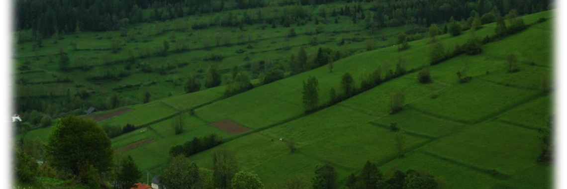
They appear as relicts in traditional cultural landscapes. Types of traditional cultural landscapes were published in the Landscape Atlas of the Slovak Republic (Miklós and Hrnčiarová, eds., 2002). Enclosed fields in some cases appear in traditional landscape type with scattered settlements, as we document in Fig. 2 in the cadastral area of Budiná and Hriňová (Fig. 7), however it is not regular. They occur as opened as well as closed forms. Both forms are documented in the cadastral area of Budiná (Fig. 3). I attached a map with potential occurrence of enclosed fields in Slovakia (Fig. 13) in traditional landscapes and a map with real occurrence of enclosed fields in cadastral areas that were mapped during the field research in 2010-2013 in the central Slovakia (Fig. 14). This research has never been published before.
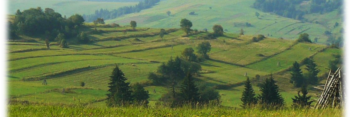
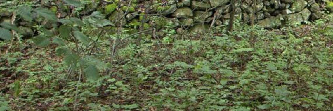
Enclosed fields correspond with land ownership and their boarder was built predominantly of stones (Fig. 4, 6 in the cadastral area of Horný Tisovník), woody plants or fruit trees were planted on the boarder (Fig. 7 in the cadastral area of Hriňová; Fig. 8 in cadastral area of Kremnické Bane). Stone walls are usually built from stones which were collected from fields during cultivation process lasting for several generations. They were predominantly used as non-intensive pastures or meadows (Fig. 1, cadastral area of Budiná, locally intensively as ploughland (Fig. 12, cadastral area of Železná Breznica). They originally were a part of mixed silvo-agro-pastoral systems (Fig. 4, 5 in the cadastral area of Horný Tisovník).
Hedges are important biotopes of plants and animals as shown several authors (Pazúrová et al., 2010, Špulerová et al., 2012, Dobrovodská, Štefunková, 1996). Anyway no mapping of enclosed fields as special structure of the landscape has been done in Slovakia.
Enclosed fields have no special relations to natural conditions. Anyway they appear mostly in mountain areas with cold and rainy summers were cambisols prevail in altitude from 300 to700 m A.S.L. They have no relation to slope, aspect, geology or hydrology.
Today they are not used intensively and in a large amount turned into forests due to missing management. They appear as fragments and relicts in sub-mountain agricultural landscapes. They are assumed to be important mostly for valuable biotopes related to traditional agricultural management and specific conditions on stone walls. Submountain agricultural regions currently suffering for population decline. Locals face hard socio-economic situation. This is the reason why turned into forests in many regions and have no longer represented value of the visual landscape. They are not related to any religious or artistic aspects. Sometimes old trees (mostly on edges) appear (Fagus s., Quercus sp., Fraxinus ex., Carpinus betulus, Tilia c.) on hedges as visual signs, marks on the boarder of landowners.
They are subject of landscape and nature protection and are included in the category called historic landscape structures (HLS). The most important law that concentrates on HLS and characteristic features preservation in Slovakia is the Act of National Council of the Slovak Republic No. 543/2002 Coll. According to the act, we can preserve ‘characteristic landscape appearance’ and ‘significant elements of the landscape’. Enclosed fields can be proclaimed as significant landscape elements in case they contain valuable biotopes and can be especially protected by cited law.
They are neglected in the landscape and are poorly known by public. Only elder locals know about them and remember land owners and families farming on these plots.
They are included in groups in frame of historic landscape structures classification: 1. historical structures of agricultural landscape with dispersed settlement; 2. historical structures of arable-land, grasslands and orchards; 3. historical structures of arable-land and grasslands (Špulerová et al., 2011). Anyway they are not defined especially as sub-type of mentioned groups.
Method of ‘identification and assessment of characteristic landscape appearance’ (Jančura et al., 2010) has officially been adopted by the Slovak Ministry of the Environment as a tool for practical landscape planning and it was developed at the Department of Landscape Planning and Design at Technical University in Zvolen in co-operation with Slovak Environmental Agency in Banská Bystrica. The Method helps us to provide arguments for HLS preservation in landscapes where existing laws provide insufficient protection. The Method contains steps of quantitative geo-data processing and landscape’s attributes evaluation in GIS as well as steps for axiological attributes assessment. Visualisation tools are used for documentation of real landscape appearance. Very important are archive and field researches. We developed a simple catalogue (Slámová, Beláček, 2004) for identification of historic landforms in terrain.
Enclosed fields are not topic in actual rural development policy, and they have not been mapped for the purpose for implementation of any national/regional Rural development programmes.
They are included in groups in frame of historic landscape structures classification: 1. historical structures of agricultural landscape with dispersed settlement; 2. historical structures of arable-land, grasslands and orchards; 3. historical structures of arable-land and grasslands (Špulerová et al., 2011). Anyway they are not defined especially as sub-type of mentioned groups.
Method of ‘identification and assessment of characteristic landscape appearance’ (Jančura et al., 2010) has officially been adopted by the Slovak Ministry of the Environment as a tool for practical landscape planning and it was developed at the Department of Landscape Planning and Design at Technical University in Zvolen in co-operation with Slovak Environmental Agency in Banská Bystrica. The Method helps us to provide arguments for HLS preservation in landscapes where existing laws provide insufficient protection. The Method contains steps of quantitative geo-data processing and landscape’s attributes evaluation in GIS as well as steps for axiological attributes assessment. Visualisation tools are used for documentation of real landscape appearance. Very important are archive and field researches. We developed a simple catalogue (Slámová, Beláček, 2004) for identification of historic landforms in terrain.
No special management is applied at any level – from national to local besides these enclosed fields that lie in the protected areas or NATURA localities. Enclosed fields are not topic in actual rural development policy, and they have not been mapped for the purpose for implementation of any national/regional Rural development programmes


